Radio Brisvaani

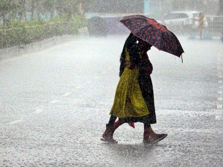
Bhubaneswar, Sep 26 (IANS) Several parts of Odisha on Friday experienced heavy rainfall amid the formation of a fresh low-pressure area in the Bay of Bengal off the Odisha coast.
The India Meteorological Department (IMD) on Friday said that a well-marked low-pressure area over northwest and adjoining central Bay of Bengal is very likely to move westwards and intensify into a depression off South Odisha – North Andhra Pradesh coasts during next 24 hours.
Since Friday morning, coastal and southern regions of the state have been experiencing heavy showers.
The weather forecast indicates that widespread rainfall is likely to persist across most districts for the next three days. The IMD Bhubaneswar Director Manorama Mohanty said the system is expected to cross south Odisha and north Andhra Pradesh around the morning of September 27, triggering widespread rainfall across Odisha.
“During the next 48 hours, heavy to very heavy rainfall is likely to occur in several districts. Extremely heavy rainfall is expected at isolated places in Malkangiri and Kalahandi, while Koraput, Rayagada, Kandhamal, and Gajapati are likely to receive heavy to very heavy rain. Other districts may also witness isolated heavy rainfall,” Mohanty said.
The IMD on Friday issued a red alert for extremely heavy rainfall, thunderstorms, and lightning with wind speeds of 40–50 kmph (gusting to 60 kmph) at one or two places of Koraput, Malkangiri, and Kalahandi.
An orange warning was issued for heavy to very heavy rain, thunderstorms, and gusty winds (40–50 kmph, gusting to 60 kmph) in parts of Nabarangpur, Nuapada, Bolangir, Rayagada, Gajapati, Ganjam, and Kandhamal,Nayagarh, Dhenkanal, Khurda, Puri, Cuttack, Jagatsinghpur, and Kendrapara.
Mohanty further added that the IMD has also advised fishermen not to venture into the sea as rough to very rough conditions are likely to prevail along the Odisha coast and adjoining sea areas. From third day onwards, rainfall activity is expected to gradually decrease.
–IANS
gyan/pgh

_page-0001")